
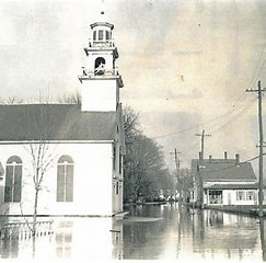
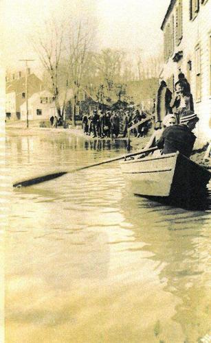
The worst possible weather combined to produce the 1936 flood: A warm front that stalled on March 11 followed an unusually cold, snowy winter. With that warm front came the first rain storm, centered on the White Mountains. It lasted until March 13 and dumped five inches of rain onto Maine, New Hampshire and parts of Vermont. Weather forecasters had accurately predicted the 1936 flood, and ample warning prevented much loss of life. Ice jams on rivers caused most of the destruction. A mark at the very top of the first story of a barn on River Road in Merrima, shows the high water mark of the infamous 1936 flood, an event that is largely forgotten today. The flood caused enormous damage all along the Merrimack River and its tributaries. It forced the evacuation of Amesbury’s Point Shore, and led to desperate measures such as dynamiting ice jams.